Showing posts with label bike riding. Show all posts

Friday, June 24, 2011

Wednesday's Ride

Seems like Wednesday has become the day we load the bikes on the back of the truck and head out to pedal a few miles.  
This week we stayed closer to home, and went to Ft. Langley, which is only about 15 minutes from here.
We rode on the Fort to Fort trail.  It starts right in Fort Langley.  We parked in the parking lot for the old fort, which is now a tourist attraction.  You know, the usual sort of thing.  The old buildings have been repaired or replicated.  There are employees or volunteers wandering in period costume, explaining and demonstrating how it was done 100+ years ago.  It is really quite interesting.  We've been in there a few times.
Here's the map of where we rode.
We actually started off the map, where the dotted line disappears in the bottom right hand corner. There is some tiny printing there that says Ft. Langley 2 km. 
You can click on the photo and zoom in.


Where it says Heritage Area is where the original fort was built, and where this plaque and cairn were located.


That's the Fraser River behind Larry.  It's still running quite high, but not as high as it was.


There was a lovely old oak tree.  I wonder if that was there in 1827.
Larry said that he'd like a maple tree like that, instead of the one we have.
Plant and tree identification is not his specialty:)


We headed on towards the Edgewater Bar area and the campsite.  The pedaling is mostly flat, with some small hills.


There were even a few empty campsites.  We would have been happy to take this one.  The mosquitoes can be notorious in this area.  I don't think they are a problem yet, as we didn't even notice any in the sheltered area, but there was such a stiff wind that it was hard to be sure.


We rode through the campsite and around the dog off-leash area, which does have some river access at one corner.  There were a couple of people there, who said that when the river is lower there is a sand and gravel bar there.  On Wednesday there was just a small muddy drop into the river.

By this time the Fort to Fort trail had turned into the Trans Canada Trail


We rode along for a while, passing through an old farm.  Yeah, the road went right through the middle of it.  On one side the barns were right at the edge of the road.


We rode to the YOU ARE HERE spot on the map at the beginning of this post, and then turned around and headed back.  
The weather was perfect, and it was a great ride.

Friday, June 17, 2011

Wednesday's Ride

On Wednesday morning we had to take Cathy back to the airport.  She was heading back home to Ontario, after being out here for a week to visit with our mother in the hospital.
We took our bikes along, and after dumping her out on the curb in the front of the departure terminal, we headed back over to Lulu Island, which is better known as Richmond.  This time we decided to start our ride in a different spot, so we were just across the river channel from Vancouver International Airport.


We were riding along the top of the dyke.  Richmond is on island in the Fraser River Delta.  To keep all that expensive real estate dry, there is a dyke around it. We hadn't been cycling long before we rode by the Olympic speed skating oval.  It has now been turned into a gigantic fitness center. 


The first part of the ride was heading straight into the wind.  When we got to the point, we stopped and watched three planes take off, about the time that Cathy's flight was due to depart.  She didn't stick her arm out of the window and wave, so we weren't sure which was her's.
It was right about this time that the camera batteries went dead, and of course I had forgotten to bring extras with me.  After we turned the corner, and were heading south, the wind was blowing at us from the side, which was much better than head on.  The map had made it look like we would be riding right along the ocean, but there was a wide expanse of salt marsh or something, a lot of green grass of some sort between us and the sea.  
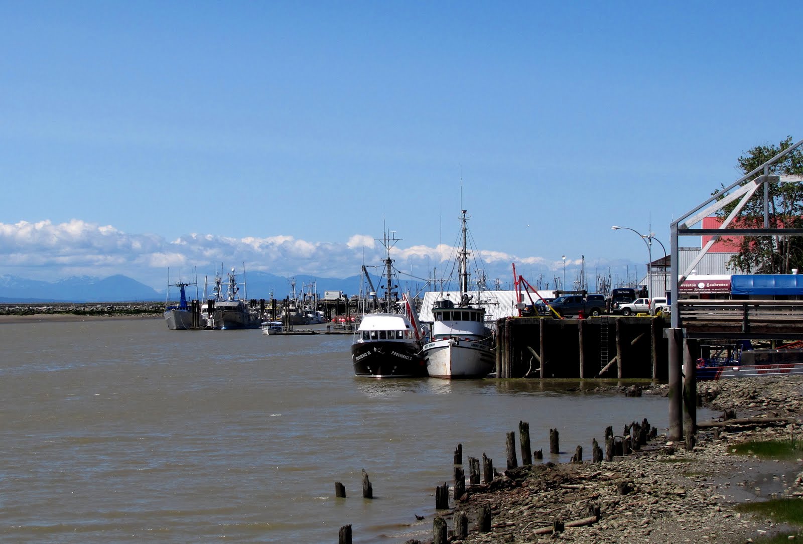
We made it into Steveston, which is a real fishing village.  The little town is all cutesy and touristy.  Even the McDonald's was made to blend in with all the other little shops.  I splurged and spent $1.49 on four AA batteries, so managed to get a few more pictures before the camera started to tell me again that the batteries were low.  You get what you pay for.  I did manage to squeeze a few more shots out of the camera, but it was a bit frustrating.


The point by the village is a park, with what they call a kite field.  It was fascinating watching two guys on three wheeled carts racing back and forth across the field, using the power of the wind on their 'kite's, which were like mini parachutes.


Garry Point kite field


It was really interesting looking at all the houses built just inside the dyke.  In other spots where the slough wasn't so tame looking, people had used all the available space and made really interesting gardens on the bank going down to the water.


I had never seen so many turtles in one spot.  There were a few of these platforms for them to get out and sun themselves.


On the first half of the ride, Larry pointed out that we were riding past a barb wire fence.  Up to that point it had been just open to the grass and driftwood.   Way out near the water we saw a herd of cattle.  On the ride back, they were all running towards the dyke.  There was a little hanky panky going on.  These cattle are Belted Galloways.  Apparently they do really well on this type of grazing.


The wind was still howling, so near the end we took the option of riding through the Terra Nova conservation area.  It was nice and sheltered in the trees.  When we turned the corner at the point, the wind was actually at our back, which sure made the last part of the ride kind of nice.


We rode about 13 miles.  It was all flat, which sounds good, but most of it was gravel, and it was all buffeted by a strong wind.  While 'flat' sounds good, the only downfall is that you have to pedal ALL the time.  No resting the legs on the downhill parts.  Here's the map.
The orange line is what we rode this week, and the red line is what we rode last week.
Next week I think we are going to pick something closer to home.

Thursday, June 9, 2011

More Bike Riding


When I was in Walmart, like I mentioned in the last post, I just happened to pass by the bike section.  I had thought about getting a bigger, more padded seat.  So I was checking out all the options, and me being me, had to weigh the cheaper options against the more expensive ones.  Anyway, I bit the bullet and went for the most expensive option.  You probably can't read that oval label.  It says 'With ergonomic relief channel for advanced comfort'.  So I got to thinking.....what exactly does that mean?  The more I thought about it, the funnier it got.  So I've decided that you can pee while you are riding along, and it will just flow through the seat and be left behind.  You've gotta be riding fast enough so that your feet don't get splashed though.  Isn't that what they mean by relief?


On Wednesday we had to pick my sister up from the airport in Vancouver, well actually it's in Richmond.  Richmond is flat, built on a river delta, and has some good bike trails.  So since I was going that way to pick up Cathy, why not take our bikes along and make it our weekly bike trip.  Her plane arrived at 1:40, so if we left home at 10 am, that would give us an hour to get there, two and a half hours to ride or sit or whatever, and time to get to the airport.  Well mostly because of me, we left half an hour late. I had rolled up some pants that I wanted to take along just in case the sun didn't come out, and then I couldn't figure out where I had left them/put them down, whatever.  Come to think of it, I still haven't seen them.  They are here at home somewhere.

So we get about half an hour from home, and it suddenly dawns on my that I've forgotten to bring along a set of keys for my mum's car.  We were going to pick Cathy up and then take her to my mum's place.  She was going to use my mum's car to go see her at the hospital, drive out to our place later, etc.  So I phoned home, where David was.  He's been fighting a bad bout of mono and strep throat since last week.  Anyway, he felt well enough to drive, so he found the keys where I had left them on the dining room table, and met us partway.  So now we had just lost another 45 minutes of riding time.

We get to Richmond, and exit the freeway right after the Massey Tunnel, at the tourist info.  We park there, and head off on a little side road that crosses the freeway and we work our way down to the river and ride along the roads and pathways, heading to the village of Steveston.   It was 12:25 when we got on our bikes.

When we were about halfway through our time, we stopped for a drink and a bite to eat.  The weather was perfect, sunny, but a nice breeze.  Okay, maybe the breeze was too nice.  Seemed like we were battling a wind both coming and going.  
Why does it always seem like that?  We were sure the wind would be at our backs on the return journey.


We rode through two really nice dog off leash areas.
See that guy just to the right of Larry's shoulder.  It was an older fellow, sat on his walker, 'chucking' a ball for his german short haired pointer.


There were some funny looking dogs there. 
Kind of blurry, but that's what you get when you are cycling along at a decent speed on gravel, and are facing sideways with the camera, trying to get a photo and not fall off.
It could quite easily have been a photo of the grass coming up to meet me.


Here's another off-leash park.  The guy in front is wearing a fluorescent vest that says 'Please Recycle' on the back, and has bags of bottles.


There's a narrow slough not far from the start, that has the most fascinating group of shacks, shanties and boats.


Needless to say, the plane landed early, and we were late getting to the airport as it was.
Since we are taking Cathy back to the airport next Wednesday, we might take our bikes again and go for a longer ride AFTER we've been to the airport.

The jury's still out as to whether that seat was $33 more comfortable.
And no, I didn't try out the relief channel.

Wednesday, June 1, 2011

Bike Riding

I'd suggested that we take this afternoon off.  Thinking that I'd get the two marmalades and a jelly that I'd planned on making today, done by lunch time.  Yeah right, it was nearly three o'clock by the time we left.  Because at that time I'm feeling a bit guilty because we aren't taking the dogs for a walk, but are leaving them at home, I end up taking them up to the old riding ring and playing ball to get them all tired out, so they'd be quite happy to go in the house and do nothing until we got back.
Maybe it was just as well we were late leaving, because it did actually rain, (really, rain, who'd a thought...?) just after lunch. 

We drove into Abbotsford and were going to ride the Discovery Trail.  We rode the first part of it a year or two ago, but this time we were going to ride the next section that hadn't yet been built the first time we rode it.  So we parked on Gladwin Rd, under the transmission lines, and set off.  The first part was all down hill, with some interesting little switch backs so that you couldn't get going too fast.  If you got going too fast and couldn't brake enough to make the tight corner, well it would have got real interesting and real ugly, real fast.  The trail is all paved (hmm, is that an oxymoron?), except for where it crosses a swampy area, and is a boardwalk.

After crossing the Abbotsford Mission Hwy, the trail starts uphill.  In a few places the trail  dumped you back out at the road, with no indication of where to pick it up again.  We just kept riding in the right direction, and always found it.  I managed to embarrass myself in front of the motoring public.  We had ridden across the road, and I decided to go up over a curb to the raised pavement behind it.  Figured I could just sort of jump the bike onto it.  Being old and well, being old, my timing wasn't quite right.  I pulled up on the handlebars an instant too soon, and the bike was coming back down as I hit the curb.  I managed to not totally fall off, but there was a bit of scrambling to keep my nose off the pavement.  Maybe one or two drivers had a funny story to tell at the supper table last night.

We passed the most interesting looking garden.  I'm guessing it is a community garden, but I'd like to check it out more sometime.


Once the uphill started, it didn't take long to start shedding layers.  Larry got rid of his jacket.


We were under the transmission lines the whole time.  
Maybe we were getting a free electrical boost to get up the hill. 
Nice fencing.  Yep, our tax dollars paid for all that.


Here we are at our end spot.  The trail continued on, and was heading quickly downhill, following Whatcom Rd down the mountain.  We decided we didn't want to go downhill, and then have to turn around and come right back up again.
Lots of uphill riding had got us really warmed up.


On a clear day, Mt. Baker would be in the distance.  That flat land is Sumas Prairie.  It used to be a lake.


It was pretty peaceful riding through this part.


The boardwalk.  The start of the last hill back up to the truck.
Just on the other side of that low part between the two hills in the distance is where the photo of the two of us was taken.


It was fun.  Hope we aren't suffering for it tomorrow.