Tuesday, May 27, 2014

All Together Now

Larry quite often lays on the living room rug to do some stretches for his back.  If Nelson sees him, he gets right down there beside him and joins in.

Oh....to be as flexible as a cat.....

IMG_7132a

Saturday, May 17, 2014

Walk with the Wildflowers

Some mornings at Oliver I will take Jake and Luna for an early walk up the mountain.  We don't go far, just up as high as the water tower, and then maybe come straight back.  Usually though once I'm up there I like to go a little farther.  This particular morning I didn't go up the gravel road to the water tower, but headed up the steep rocky trail that starts at the bottom of that road and goes up to the north, putting a steep gully between me and the water tower.  When I had been up there just before we had gone to Alberta, I hadn't taken the camera, and of course wished I had, because there were all sorts of wildflowers blooming.  I had the camera with me this time.

The mountain, which is not much more than rock and sand, has greened up a bit.  I haven't figured out what this shrub is yet, although the leaves look sort of familiar.

IMG_7079

IMG_7080

I don't think Jake is overly fond of going up there.  I think he 'knows' that things are out there to get him if he isn't careful.  He stays close and rarely steps off the trail.  Luna is a slow learner, or maybe just doesn't care, but I got tired of picking chunks of Prickly Pear cactus off her feet and legs.  She refuses to move when she gets stabbed, and it's kind of funny if she has it on two legs, because then she doesn't know which one to hold up.  Those sharp spines are wicked.

IMG_7081

The darn stuff is hidden in the grass and grows in a big clump
.

In the end I put Luna back on leash.  That seemed to keep her Prickly Pear free.  We headed up another steep trail on to the top of a rocky knoll with great views over the town.

IMG_7083

IMG_7084

IMG_7086

IMG_7089

IMG_7092

IMG_7093

IMG_7094

IMG_7096

We headed back through a little valley.  If I get there early enough it is still in the shade.  Not this time though.  I love walking through there, I find it a very special place.

IMG_7097

IMG_7102

Not sure what these were.  I am assuming they were trying to attract a certain insect, but for what reason, I don't know.

IMG_7098

IMG_7104


Almost back to where we started.  That's the water tower on the other side of the gully, behind Jake.   You can just barely see the radio tower between the clouds, 3/4 of the way up the edge of the mountain.

IMG_7105

The previous trip up here, I was just a bit farther along past Jake, where the trail swings to the left just before I slithered back down the rocky trail to the road.  Suddenly out of the valley walks this tall man (at the time I was sure he was wearing robes).  He was walking with a long staff.  I immediately thought of Moses coming down off the mountain.  It was like he had appeared out of nowhere.  Luna hadn't seen him yet, but I knew if she did she would probably start barking madly at him.  A strange man, suddenly appearing out of nowhere, and carrying a big stick.....she would. not. like. that. at. all.  So I hustled her to the steep rocky trail and headed down as fast as I could, hoping I wasn't going to loose my footing and slip and fall.  I figured 'Moses' would keep on going, and cross the gully to the water tower.  I daren't look back, because I didn't want Luna to notice, but I could hear the sound of rocks behind me.  I got to the bottom and snapped the leashes on and marched off as fast as I could.  I knew 'Moses' was still coming because Jake kept stopping and looking back, I'm sure he thought it must be Larry.  Eventually I turned one way and he kept on going, and really he was just a guy, maybe wearing some sort of short tunic, with a messenger type bag over one shoulder.  Reading this now it seems kind of funny, but at the time it just seemed rather creepy.

This particular morning there was no sign of Moses.  Just more flowers.

IMG_7109


At the bottom of the road to the water tower is a long hedge of lilacs.  The smell is wonderful.

IMG_7111

There are lilacs everywhere around Oliver.  There are some in the hedge along the property next to us.  When we arrived in the evening, as soon as I opened the truck door in the carport, that was all I could smell.  What a welcome:)

IMG_7110

Friday, May 16, 2014

We Can Be a Tourist in Our Own Province Too!

We continued our drive back across B.C., doing the two hour driving shifts, then walk and potty break, and then change drivers schedule.  There was the odd extra stop thrown in there as well.  This was Sparwood, near the Alberta border.  
Who doesn't want to see the biggest truck in the world.  Well it didn't really bother me, but I said we should stop, just because.


IMG_7055

IMG_7054

I guess I forgot to photograph the sign that said about having to hand make all the individual parts for this truck when something needed repairing.  Can't remember what it was that eventually had to be replaced, and that was when they decided that the cost wasn't worth it.  So now here it sits.

IMG_7052

We did see a few elk signs along the way, and then suddenly two crossed the road, and after that we saw some herds grazing in the fields.
Our wildlife count was umpteen deer, a bunch of elk, only lonely scraggy looking mountain sheep, two coyotes, two wild turkeys (I think the turkeys were a first), and a bunch of different raptors in Alberta, and a bald eagle in BC.

IMG_7056


Heading back over Kootnay Pass.  You could see where there had been small avalanches across the road.  I don't think I'd want to drive through here in winter.

IMG_7061


This was a rest stop just east of Castlegar.  We stopped here both coming and going.  This time we decided to take the trail that went up the rock bluff and got these amazing views from the top.  See the rain shower off in the distance?  Right where the river 'ends' in the middle of the picture, is where the highway crosses the river .

IMG_7071

IMG_7072

While we looking at the view, there was a bald eagle circling just below.  I managed to get four shots (once again I forgot to just hold the shutter down...grrr), none of which were in focus.  This was the best one.  It was pretty cool to be looking down or straight at the flying bird, instead of having to look up.

IMG_7068

When we got out at the rest stop, I went to get Calli out of the back of the truck.  She was fast asleep.  She is really deaf now and didn't seem to have noticed we had stopped, so I just left her there.  There was a convenient rock to pose Jake and Luna.

You look to the right, I'll look to the left
IMG_7074

Jake, is she finished yet, this is sooooo boring.
IMG_7076

Hmm, there's someone else down there now.  They'd better stay away from our truck!
IMG_7077

12 hours after we had started out that morning, we arrived back in Oliver.  It's a pretty time of the year to travel.  Most places, although not all, the trees were in the process of leafing out.  Everything was fresh and new and colourful and green.   The Saskatoon bushes were blooming on the hillsides.  The sun was shining in B.C.  As for that Alberta, next time we'll have to go in the summer I guess.


Tuesday, May 13, 2014

Playing Tourist in Alberta

  We had a great visit in Alberta, went back to Oliver for a couple of days, and then headed home.  I had my first farmers market last Saturday, and I had two days of heavy jam making to do to make up for my procrastinating.  On Friday morning, we had no internet, and it suddenly magically reconnected mid morning yesterday.   We had tried all sorts of things, and had left messages with the tech department of our internet provider (never heard back), so not sure why it was suddenly working three days later.  Anyway, I'm continuing on with our Alberta sage from the weekend before, which is old news now, but that's the way it goes.

On Sunday, when we were in snowy Alberta, we took a drive to Lethbridge. There was no snow in Lethbridge, but it was raining.  First we went down a lot of the gravel range roads, through a Hutterite colony, and then onto the freeway that we were a little too familiar with from Friday night's side trip.  Lethbridge seemed to have everything you wanted in the way of shopping.  It was built up above the river, which was down in a valley with coulees running down into it.  I couldn't help but notice all the trails and paths heading down, thinking what a great place to walk dogs:)  
There was this amazing train trestle that spanned the valley.

IMG_7023

By the time we got back after our shopping trip, the snow had melted off the back lawn, and I tied the dogs out there for a bit, the sun was even out.  Now you'd figure the dogs would be glad for a change of scenery from the inside of the truck, but that is the only time that Luna 'complained'.  She kept doing this annoying little yip.

Monday morning the relatives were heading to work, and we were heading back to B.C.  It wasn't too far out of our way, so we decided to take a bit of a side trip and go to Head-Smashed-In Buffalo Jump.  

IMG_7029


I think you can probably figure out what it was from that name.  Kind of gruesome when you think about it. 

IMG_7038

IMG_7037

IMG_7035

IMG_7031

IMG_7032

 We had thought we could take the dogs for a walk there, but the first thing we see is a sign telling us that no pets are allowed on the site.  So we walked the trails and read the signs and were most disappointed that we couldn't get to the top.  You have to pay to do that, and the visitors center wasn't open for another hour.  In the end we took the dogs for a walk down the road to the overflow RV parking lot.  

Looking out to the east.

IMG_7034

A raptor that landed below us.

IMG_7030

Back out to the highway, into Fort Mcleod for a fill up with cheaper gas, and off to the west we headed.  It had been snowing a bit at the buffalo jump, and then it just got whiter and greyer and very wintery seeming.  

 I really find the windmills fascinating.

IMG_7042

IMG_7043

And then we passed over the Frank Slide.  The slid away mountain side was mostly hidden in the clouds, but no missing all that rock on either side of the road.  

IMG_7044

IMG_7045

The weather is more extreme here, so despite the slide happening more than 100 years ago, Mother Nature hadn't been able to disguise it at all.

IMG_7047

Shortly after that we crossed back into B.C. and the clouds parted and we saw the sun. 

IMG_7050

 The rest of the trip was a mixture of sun, cloud, rain, it seemed to change every 10 minutes.  

Friday, May 9, 2014

Summer to Winter

Last week we drove to Oliver mid-week, and then on Friday we left from there early in the morning and drove across the rest of the province and into Alberta.  We were going to visit some relatives that moved there a couple of years ago, to retire, sort of.  They went the opposite way of most retirees, leaving a little town with mild temperatures right on the ocean, to the cold winters and flat land of Alberta.

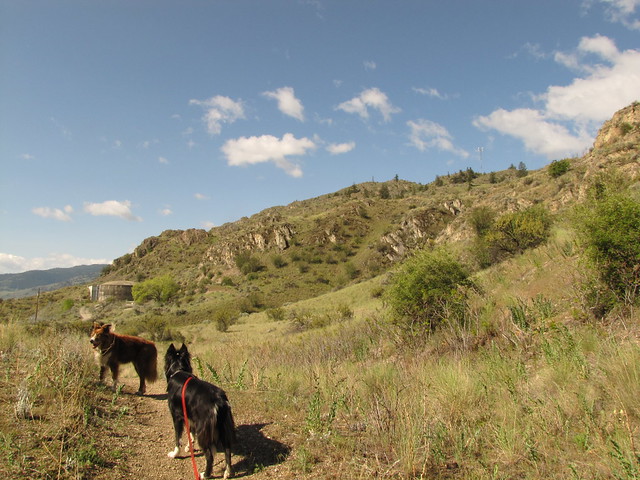
We new it was going to be a long drive, so we left Oliver just after 8 in the morning.  It was a beautiful day.  It was summer in southern B.C.  We were in shorts, t-shirts and I was wearing sandals.  We drove in two hour shifts, switching drivers at that point, and usually finding a rest stop close to the two hour mark.  We'd get out, and take the dogs and ourselves for a little walk and a potty break.  There was only a slight hitch.  The day before the handle on the truck tailgate broke.  Something must have seized up inside and the handle snapped on one side as Larry was yanking on it.  There was no way to get the tailgate open.  Calli, who was riding in the canopy in a crate, had to be hauled in and out over the tailgate every time.  Definitely awkward.

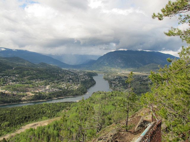
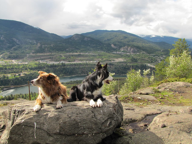
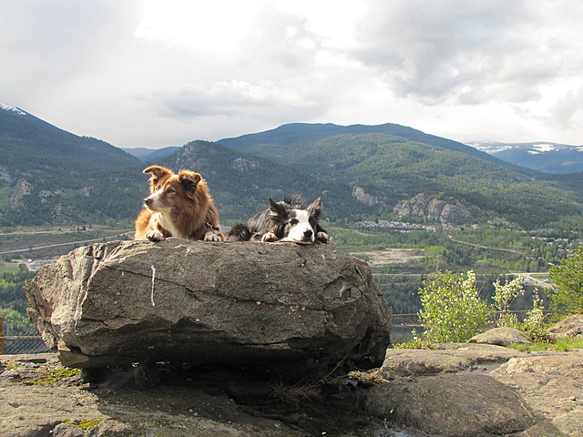
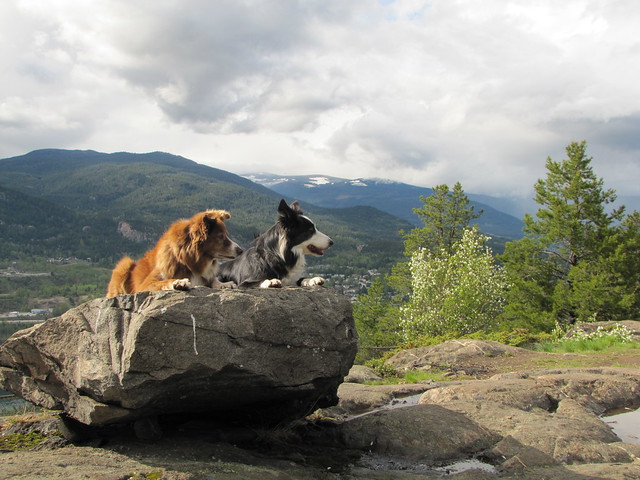
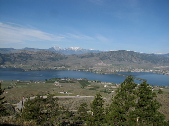
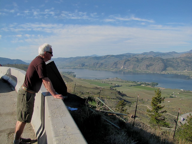
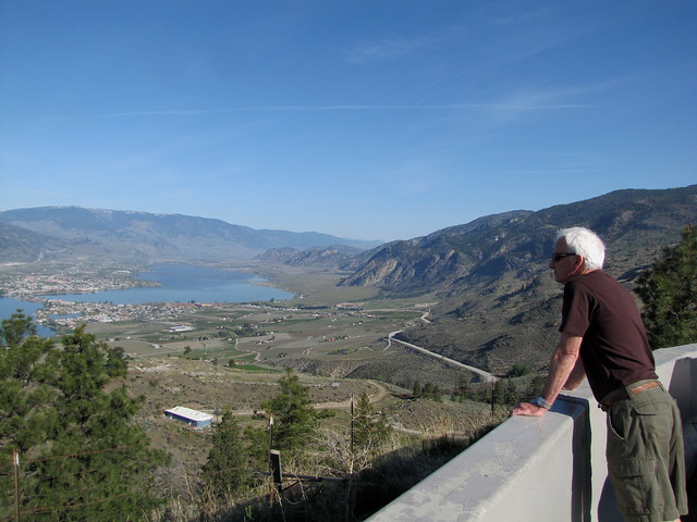
About 25 minutes from Oliver, we stopped at the lookout on Anarchist Mountain, looking west over Osoyoos, which is 15 minutes south of Oliver

IMG_6986


Looking to the south.  The Canada/US border crosses about halfway along that stretch of the lake.

IMG_6987


Looking north.  Oliver would be somewhere between the two mountain ranges in the center of the picture.  Osoyoos as well as Oliver are the northern tip of the Sonoran Desert than extends into Mexico.

IMG_6988


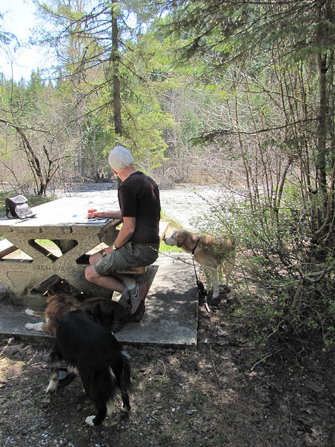
It was so warm at our lunchtime stop that we perched on the end of the picnic table bench in the tiny bit of shade there.

IMG_6992


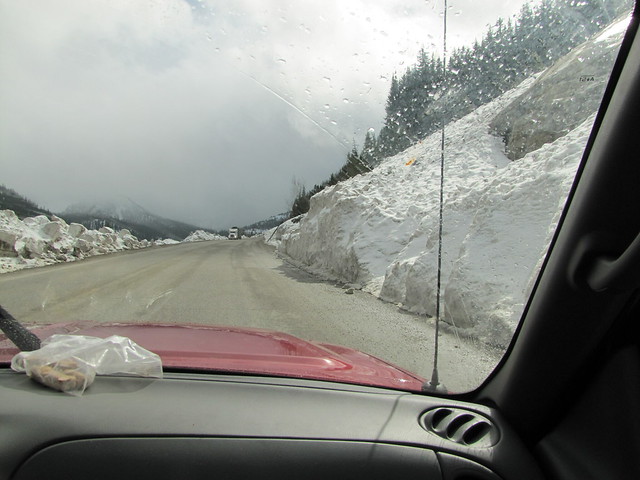
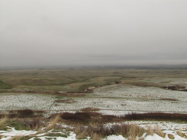
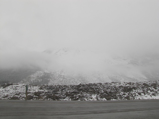
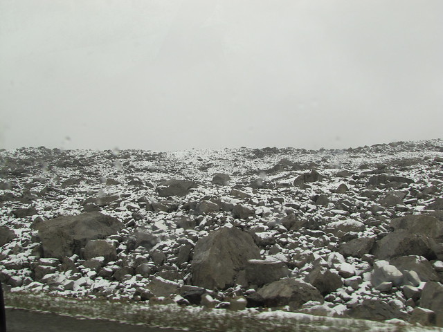
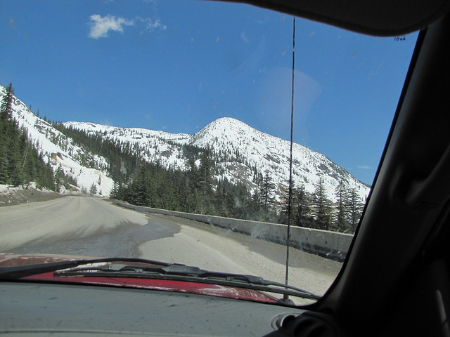
We went over numerous mountain passes.  Oliver has an elevation of just under 300m, and is just slightly higher than Osoyoos, which was probably the lowest part of our trip.  Kootenay Pass was the highest at 1774 m (5820 ft).  Still lots of snow up there.

IMG_6994


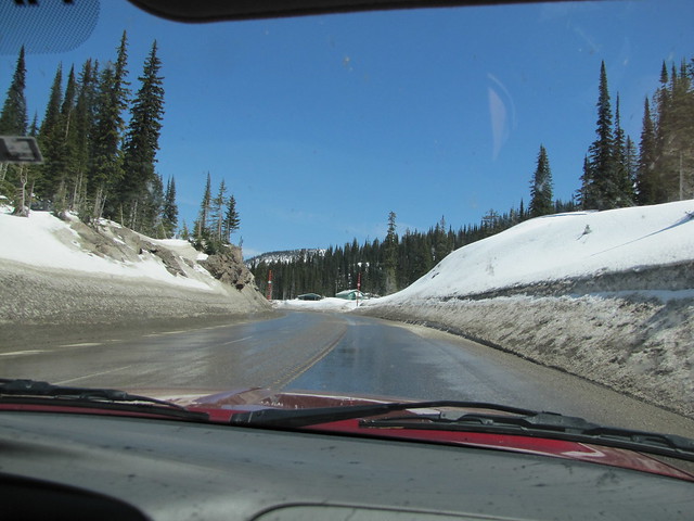
Those are dirty piles of snow beside the road.

IMG_6995


At the top.

IMG_6996


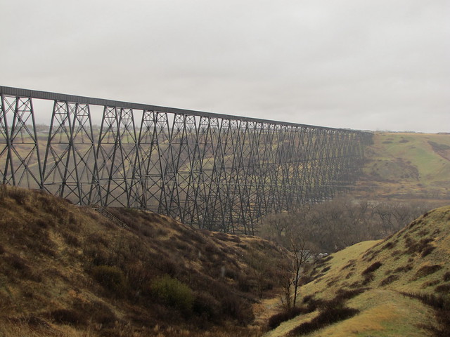
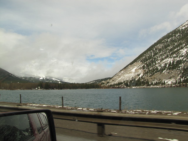
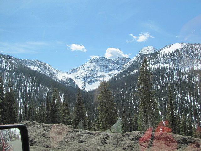
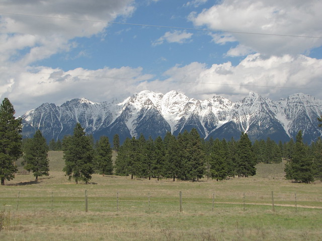
The start of the Rockies.  I was driving at this point, and this was the view out of my window.  I was trying to get Larry to take a photo, but then quickly pulled over, snapped a few myself, and then whipped back onto the highway before the semi-trailer that was behind us could pass.  He was probably cursing me for the second time, as not long before I had pulled out of a rest stop in front of him.  It's all about not getting stuck behind a slow vehicle:)

IMG_7000

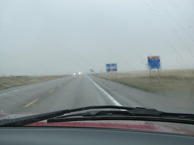
Not long after we turned from going south east, to heading north east.  Between a couple of mountain peaks we could see dark clouds boiling up.  As soon as we passed into Alberta the weather changed.  Cold, dark, clouds on the ground, and rain.  Ugly.  We had to stop for gas (about 8 cents cheaper in Alberta) and I pulled my winter clothes out of the back of the truck and climbed into them quickly. Brrrrr!

IMG_7004


We turned off on a side road further along, stopped and fed the dogs, and Larry stood behind the truck, white knees knocking as he shed his shorts and climbed into his jeans.  We planned on stopping in Fort McLeod for something for supper.  We were so focused on getting there that we didn't notice that the turn off we needed to take to head north was just west of town.   Our map, yes, we still use maps, made it look like the turn off was in town.  We drove down a one way street and turned onto what we thought was another one way street going the other way, and then found out it was a two way street when another truck was coming right at us in the left lane. We stopped and got something to eat and then headed out of town and took the only road we saw, but just had this feeling that we might not be on the right road.  We drove miles without a highway sign appearing to confirm where we were.  Eventually we figured out that we were heading east instead of north, and then struggled to find somewhere to turn off the freeway so we could head back the other direction.  We figured we drove an extra hour, which was NOT what we wanted to do at the end of a long day of driving.  I blamed it on the weather, if we had been able to see the sun, we would have known which direction we were heading:)   Eventually we got there, about 12 1/2 hours after starting out.
 Earlier in the week I had checked the weather forecast.  14 C (57 F) sun and cloud.  I figured that was good.  We were going to kennel the dogs in the truck, as the people we were visiting are not dog people.  I thought we would be able to sit outside in the sun, and the dogs could be out on the grass.  We took the x-pen along.  Imagine my horror to see the forecast change on Tuesday to just above freezing and snow for the weekend.   In the end we drove the truck into the garage, and that at least made it a few degrees warmer for the dogs.  Not their choice on how to spend a holiday, but they did okay and it was only for two days.

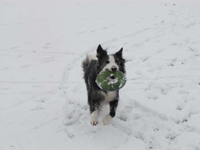
Saturday morning we woke up to this.  I suppose it was better than rain, but the novelty wore off pretty fast.

Photo: Looks like we picked the wrong weekend to visit Alberta:(  Shorts and sandals weather until we hit the Alberta border, and this morning we woke up to this.  The dogs didn't mind it though!

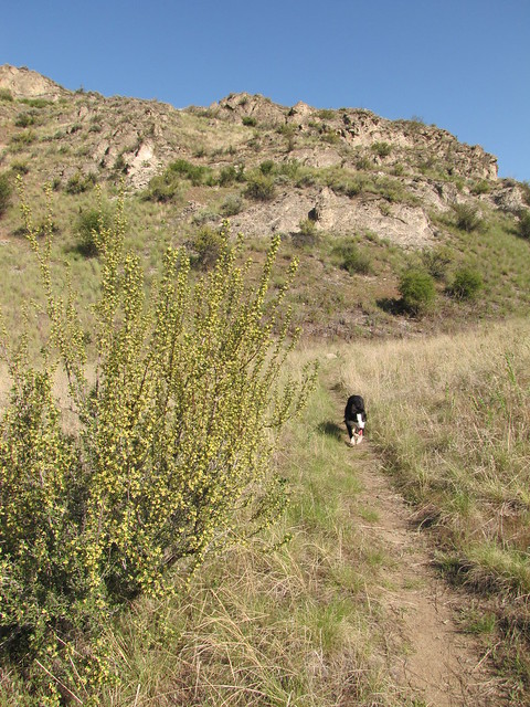
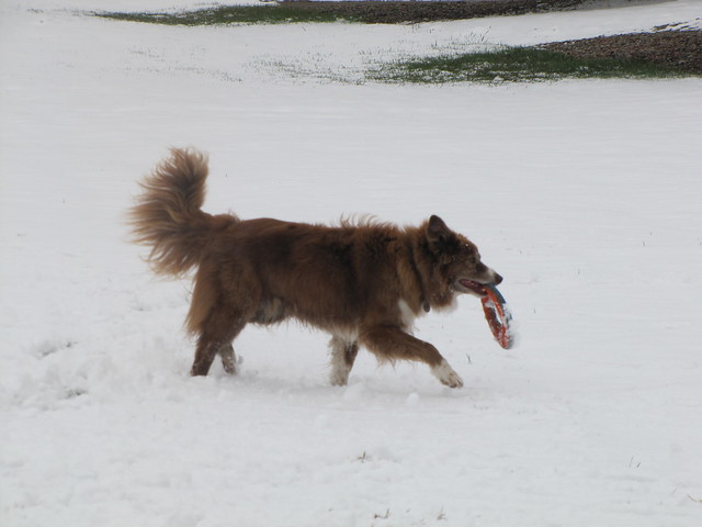
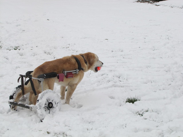
The dogs thought it was fun though.
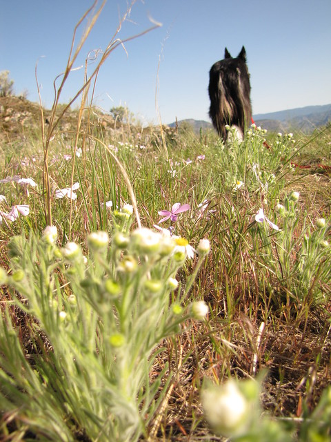
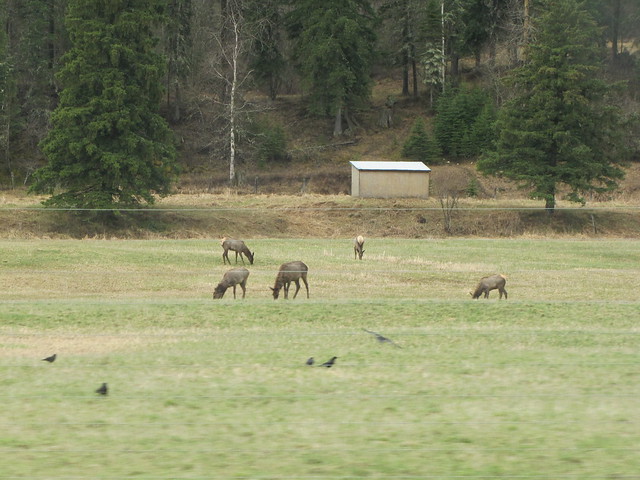
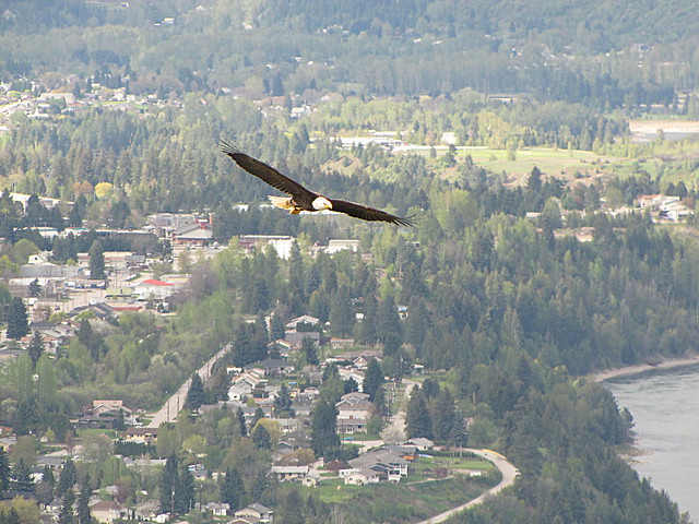
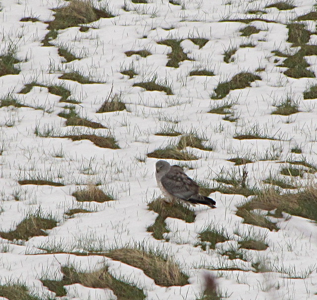
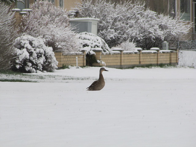
IMG_7010

IMG_7011

IMG_7013


We had a spectator

IMG_7015

I didn't think it was much fun when I was stood at the dog off-leash that afternoon, snow blowing sideways into me, throwing frisbees for the dogs, and wondering why I was in this place with it's crazy weather.