
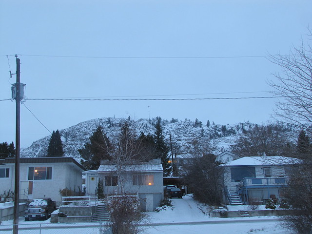
Back in January we made an attempt to hike to the radio tower, which you can just see on the top of that rocky hill, looking from our back yard. It was a dull snowy day, and we hadn't really planned on going to the top, but we just kept on climbing, and in the end we had to turn back because we were scared of running out of daylight.
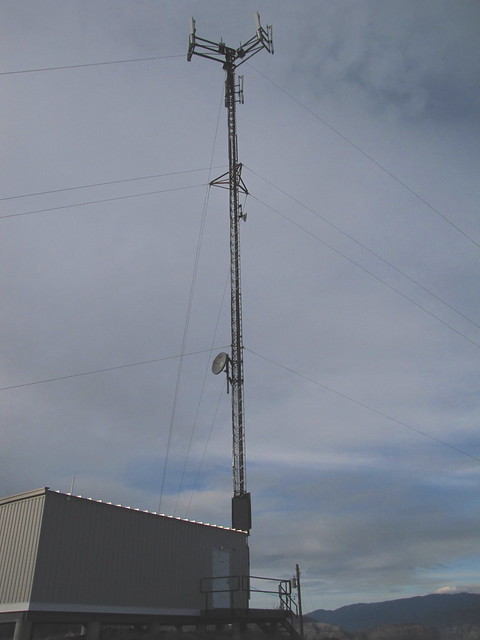
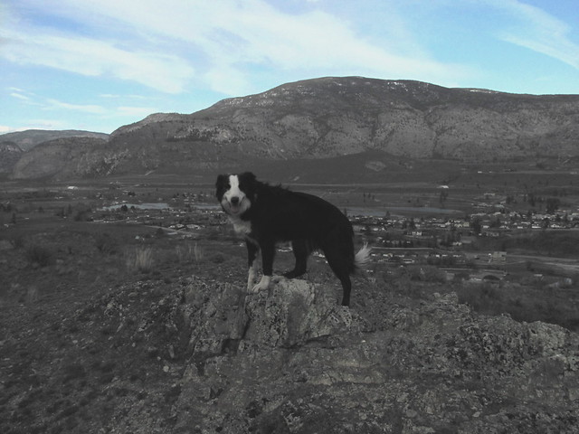
This last trip, we decided to hike up a trail that started from the 'Welcome to Oliver' sign on the north side of town, which would be out of the above picture, off to the right. We were going to walk to the start, but ended up driving the down the highway in the truck, and parking it by the sign. We just knew the trail went up the hill, but didn't know how far. It was really steep in spots, steep enough that at times I was putting my fingers on the ground in front of me to try find something to help haul me up. We had Jake and Luna with us, and they did collect a few chunks of cactus now and again. It wasn't long before we reached the spot were we posed the dogs on the rocks, and had the deer peering over the top looking at us, on our last visit. There was a wide trail heading up the hill, and so we just kept walking, and climbing. After a bit we realized we were getting close to the radio tower, which was off to the south. No worries about fading daylight this time, so we just kept going. Eventually the trail was actually passing behind the radio tower, and we had a bit of a 'discussion' as to which trail to take. There was a smaller trail heading off in the right direction, but Larry didn't think it was the right one because it didn't look used enough. He kept going on the main trail, and I turned off on the other one. Those traitors of dogs decided to keep going with Larry. And then I was alone, and it seemed so quiet. All I could think of was that we had just done what you really aren't supposed to do. We'd split up. I kept going along my little trail, it was was taking me right up to the tower. I was wondering where Larry was, and luckily I saw him way off in the distance standing on some rocks looking around. I screamed and yelled and finally he heard me and eventually we were all together at the top. Success. It's a 1300+ ft elevation gain to get to the top. It had taken us about an hour.
There was a big heavy wooden helicopter landing pad up there. Makes sense I guess. Can't expect the maintenance guys to hike up the mountain every time they needed to go up there. We had taken a water bottle with us. Jake and Luna were so desperate for a drink that they were nudging at the bottle as I was getting it out of the holder. Never seen them do that before. We had forgotten the doggy water bottle with it's built in dish. So one small swig for Larry and I, and the rest was given to the dogs. One poured water into the other's cupped hands, and the dogs drank it all.
Unfortunately I'd taken the camera without the case and the spare batteries. So then I find out that the batteries are low, and by that time you get that warning, there might only be 6 or 8 pictures worth of life left in the camera. I was quickly pointing and shooting. Unfortunately I didn't notice that the setting had been switched from Av to Tv, and most of the pictures were almost black. I managed to salvage a few, but the colour is mostly washed out.
Looking to the east. That's Mt. Baldy. No, not the bald patch surrounded by white, on the right in the photo. It's that white mountain in the middle:) It's a ski hill.

David and his girlfriend went there in February. It was midweek and actually was closed that day. It was a day for the employees to ski. The employees said they could ski with them for free, and gave them free ski and boot rentals as well. How's that for going above and beyond?
Looking to the north east. The old part of town where Wyndson Cottage is, was hidden by the mountain slope.
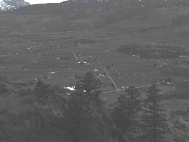
Looking south. We'd ridden our bikes on most of those roads the day before.
We spotted another trail leading down on the east face, and a few minutes down there we recognized the spot where we'd turned around in January. It was a shorter route down, and we were glad to be able to get in the truck and drive home.
You made it! What a view! I always try and take my water bottle that has the top that you can squirt water out of..if Chance is thirsty I tip it up and gently squeeze it right into his mouth. Then I can still take the cap off and have a drink myself:)
ReplyDeletehappy Easter! :)
ReplyDeleteSuch lovely country, no deer this time!
ReplyDeleteBEAUTIFUL :0)
ReplyDelete